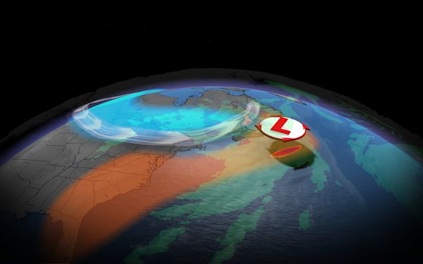
Snowfall totals are expected to range between 10-30 centimeters before transitioning to rain
A powerful storm is set to hit Atlantic Canada this weekend bringing with it a potent mix of damaging winds, heavy snow, and the potential for coastal flooding.
Residents are advised to take precautions, secure loose outdoor objects, and avoid unnecessary travel during the height of the storm.
Storm approaches Newfoundland Saturday
The storm is expected to spend much of Saturday out at sea, rapidly intensifying as it approaches Newfoundland and Labrador. Overnight, strong easterly winds will begin to pick up across the Avalon Peninsula, and heavy snow is forecast to begin falling.

Snowfall totals are expected to range between 10-30 centimeters before transitioning to rain.
Active weather anticipated Saturday into Sunday
Gusts exceeding 110 km/h are likely along east and north-facing shores Saturday, posing a significant threat to property. However, these fierce winds are expected to subside dramatically overnight on the Avalon Peninsula as the storm’s “eye” passes over.

While the Avalon Peninsula will bear the brunt of the strongest winds, Cape Breton and, to a lesser degree, Prince Edward Island, will also experience strong winds.
Snowfall will transition to rain from east to west across the island, but as the storm stalls over Newfoundland and weakens, snow is expected to return.
Stay tuned to The Weather Network for the latest updates and warnings.
Source: First Nor’easter of the season targets Atlantic Canada – The Weather Network

